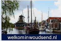
8551 PS Woudsend
Iewâl 2
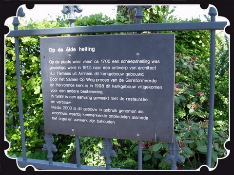
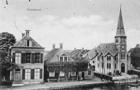
Woudsend
Wwoudsend friesland iewal 2 eewal
8551 PS Woudsend Iewâl 2 Dreamhûs
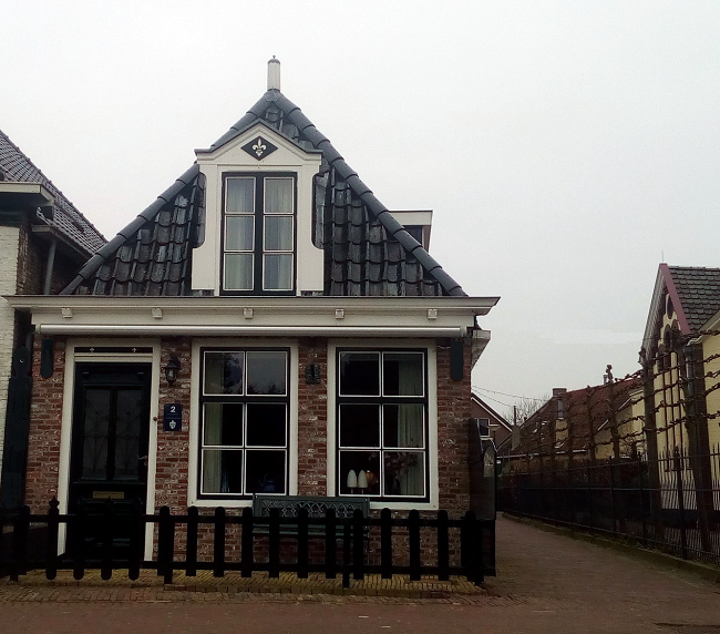
De Iewâl 2
The Iewâl 2
staat voor Smidsteech 2
Stands for Smidsteech 2
en naast het "Kerkgebouw"
and next to the "Church Building
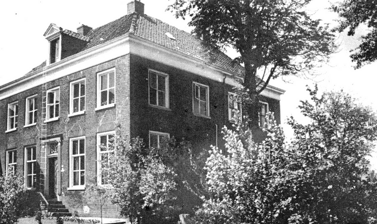
Eewal 2 ( Iewâl 2)
Bekend vanaf 1652
± 26 bewoners
Eewal 2 ( Iewâl 2)
Known from 1652
± 26 residents
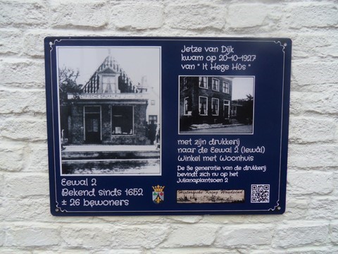
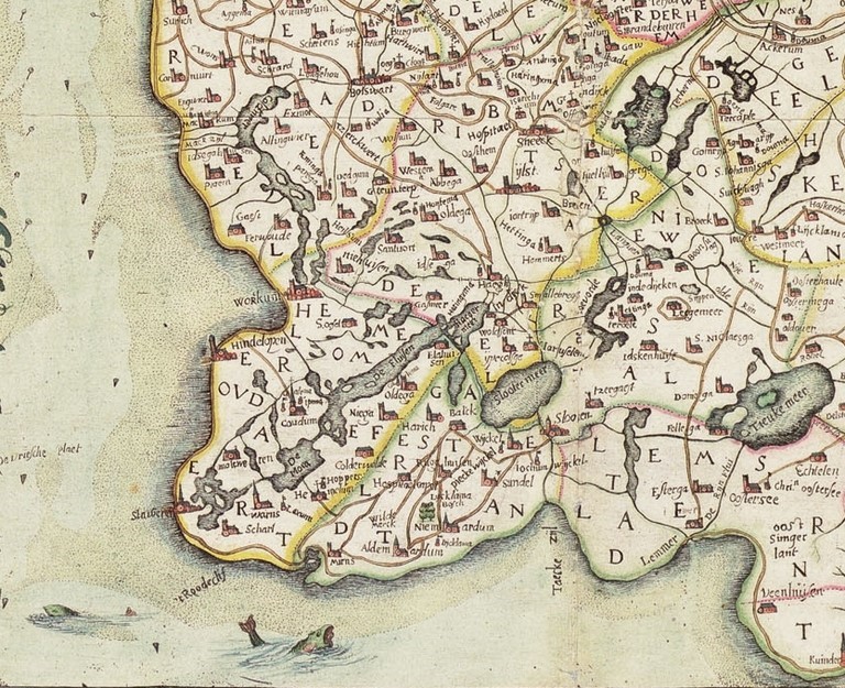
Friesland Anno 1622
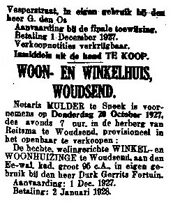
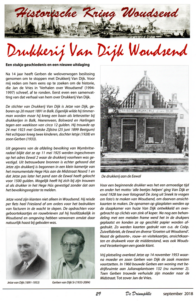
Jetze van Dijk
kwam met zijn drukkerij
van "It Hege Hûs"
(Midstrjitte 1)
Jetze van Dijk
came with his printing company
from "It Hege Hûs"
(Midstrjitte 1)
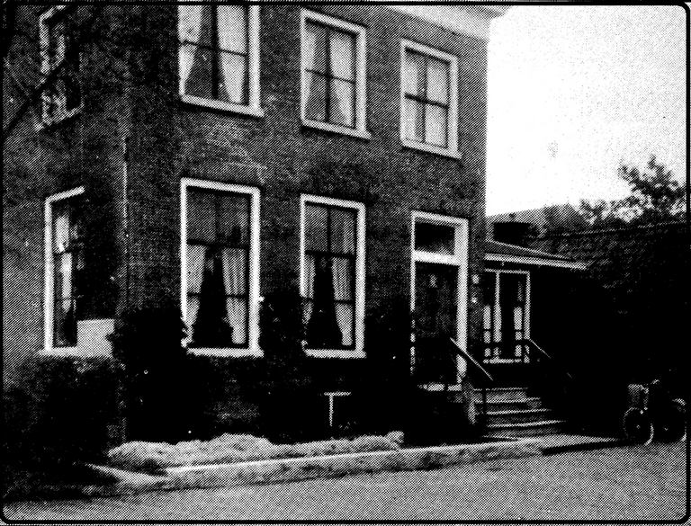
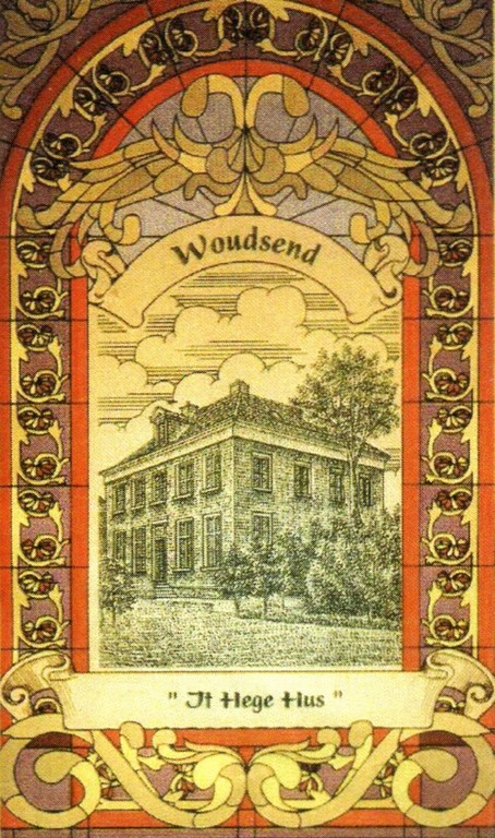
naar de Eewal 2
op 20-10-1927
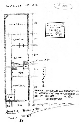
Kadaster nr: A 282
Winkel met Woonhuis
to the Eewal 2
on 20-10-1927
Land registry no: A 282
Shop with Home
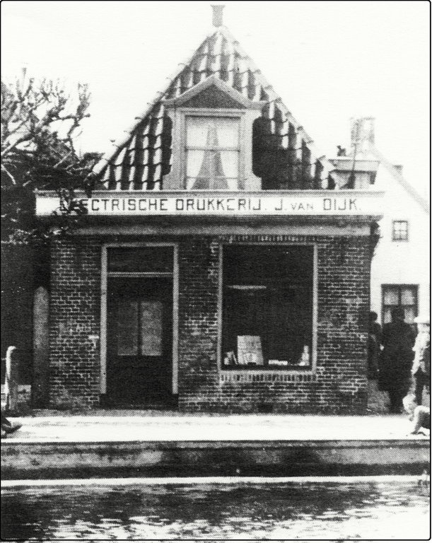
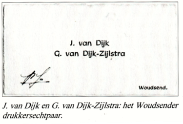
J.van Dijk
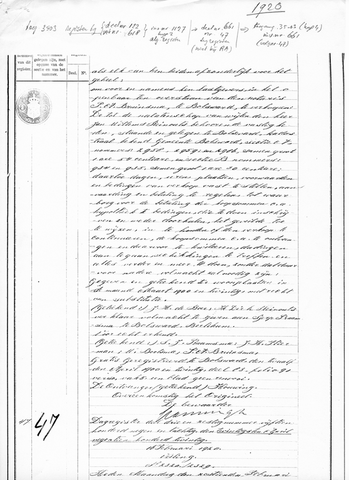
Jetze van Dijk werd geboren op 20 maart 1891 te Balk
Jetze trouwde op 24 mei 1923 met Gretske Zijlstra
en kreeg 2 kinderen
dochter Ietsje 21 februari 1928
en zoon Gerben 14 juli 1933
Ze werden ingeschreven in Woudsend
op 11 mei 1925
en kwamen via "It Hege Hûs"
naar de Eewal 2
20-10-1927 voor f. 1500,--
J.van Dijk
Jetze married on 24 May 1923 with Gretske Zijlstra
and got 2 children
daughter Ietsje 21 February 1928
and son Gerben 14 july 1933
They were enrolled in Woudsend
on May 11, 1925
and came through "It Hege Hûs"
to the Midstrjitte 1
to the Eewal 2
and bought the House
20-10-1927 for f. 1500,--
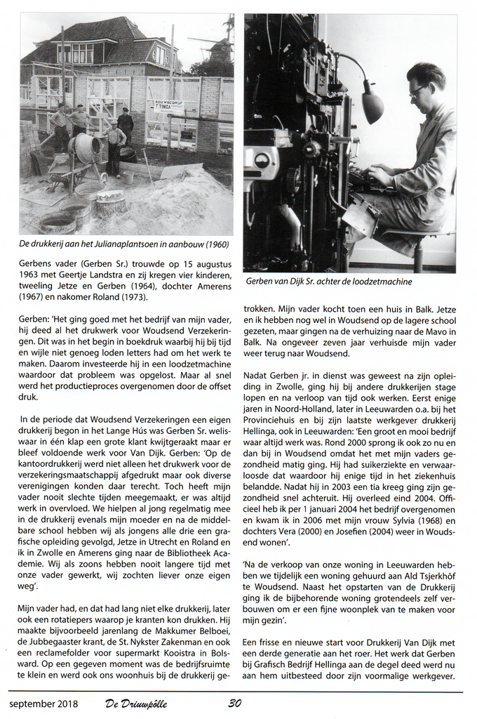
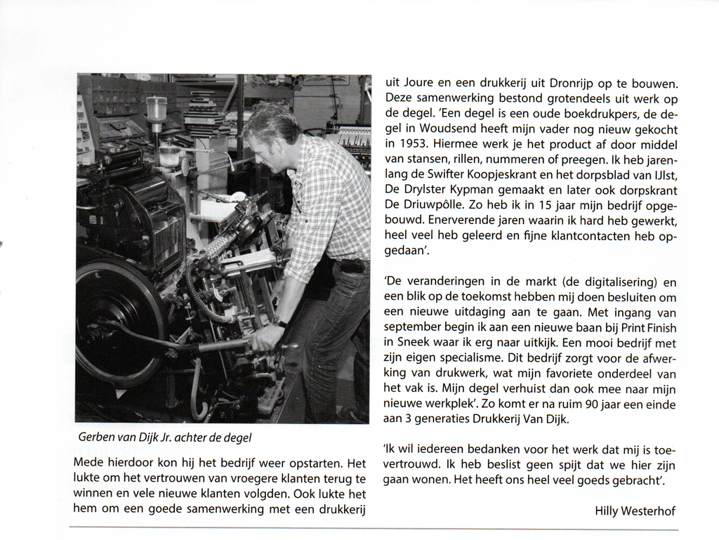
De drukkerij is beëindigd
in Augustus 2018 door
de 3e generatie
Gerben Jan van Dijk
The printing business has ended
in August 2018
the 3rd generation
Gerben Jan van Dijk

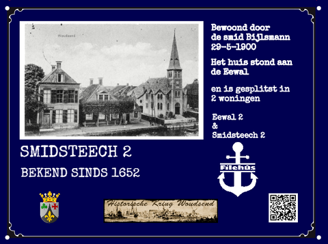
De vorige bewoner was
D.G. Fortuin
The previous resident was
D.G. Fortuin
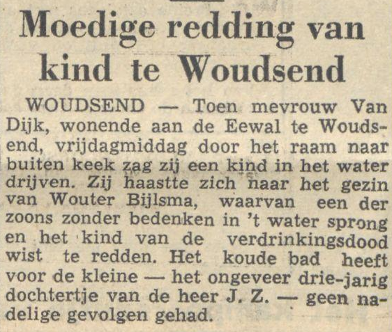
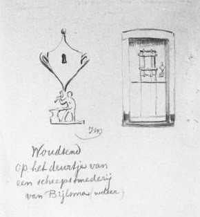
Daarna was het Jan Bijlsma
de smid.
in het dorp bekend als Jan File
Then it was Jan Bijlsma
the blacksmith.
in the village known as Jan File
Geschiedenis Woudsend
De zandopduiking waar het dorp Woudsend op gelegen is, is vermoedelijk al vroeg bewoond door wat boeren en vissers. De ontwikkeling van Woudsend als dorp heeft waarschijnlijk plaats gevonden na de vorming van de
grote meren en de vaarwegen.
Van oorsprong is Woudsend een agrarische nederzetting behorende bij het dorpsgebied van Ypecolsga. De ontwikkeling als zelfstandig dorp is na het jaar 1000. Het oudst bekende jaartal waarin Woudsend voor het eerst genoemd wordt is 1337. In dat jaar is er een klooster van de paters van de Carmelieten gesticht.
In de eerste fase van de ontwikkeling bestond het dorp uit het klooster en de daarbij behorende kerk en korenmolen met enige bebouwing langs het pad in noordelijke richting, de Midstrjitte.
Het dorp is verder gegroeid door een toename en verdichting van de bebouwing langs de Midstrjitte en de Kamp, het pad dat liep van de molen naar de Midstrjitte.
Vooral door de gunstige ligging aan belangrijke vaarverbindingen ontwikkelde Woudsend zich tot een handels- en scheep-vaartnederzetting. De Woudsender Ee maakte vanouds deel uit van de vaarroute vanaf de Zuiderzee (IJsselmeer) naar Sneek en IJlst en voor de indijking van de Middelzee ook naar Leeuwarden.
De grootste bloei beleefde Woudsend in de 18e en 19e eeuw.
Dit was vooral te danken aan de Sontvaart die in 1710 begon.
Omstreeks 1750 hadden 25 à 30 zeeschepen Woudsend als thuishaven.
In 1749 telde Woudsend 734 inwoners.
Meer dan een derde deel van de beroepsbevolking was werkzaam in de visserij en de scheepvaart
met daarmee verwante bedrijven.
Woudsend had naast scheepstimmerwerven – waar voornamelijk zeeschepen werden vervaardigd – 2 houtzaagmolens, 2 leerlooierijen, 3 mastmakerijen, 2 zeilmakerijen en 1 touwslagerij.
In 1762 is een gedeelte van de overzijde van de Ee geannexeerd bij het dorpsgebied voor de expansie van de bedrijvigheid. In 1840 bedroeg het aantal inwoners 1200 en in 1890 zelfs 1400. De scheepswerven en pakhuizen langs de westkant van de Ee maakten geleidelijk aan plaats voor woningen en de bebouwingsdichtheid nam (vooral langs de stegen) verder toe. Een viertal stegen had voorheen het karakter van een smalle opvaart. Deze opvaarten zijn echter al in de 18e eeuw gedempt.
Tot het midden van de 19de eeuw was Woudsend vrijwel alleen over water bereikbaar. Pas na 1850 ontstond de huidige verbinding (De Dyk) over land, die in het midden van het dorp leidde tot een doorbraak in de dichte bebouwingsstructuur. Aan deze weg kwam enige woningbouw tot stand. Een andere grote wijziging in de ruimtelijke structuur voltrok zich rond 1950 met de demping van de Weisleat, waardoor een goede oostwestverbinding over de weg kon ontstaan.
De verdere ruimtelijke ontwikkeling van Woudsend speelde zich vooral af in de naoorlogse periode. Er ontstond bebouwing aan de noordwestzijde van het oude dorp, aan de zuidwestzijde en in de nieuwe wijk It Skar, die zuidoostelijk is gelegen. Forse bedrijfsontwikkeling vond plaats aan weerszijden van de Vosseleane en ten noorden van de Welle. Door de recente aanleg van een rondweg om Woudsend met het ‘Ie-Akwadukt’ en de ‘Nije Wellebrêge’ kon de doorgaande weg door Woudsend omgevormd worden tot verblijfsgebied.
Het oude dorp zelf is beschermd dorpsgezicht. In het hart van het dorp is de historie nog zeer goed afleesbaar. Ten opzichte van het kadastrale minuutplan uit 1830 is slechts sprake van kleine veranderingen. De demping van de Weisleat en de aanleg van de Dyk zijn het meest in het oog springend.
Plaatsnaamverklaring Het dorp wordt voor het eerst genoemd in 1446 als Woldensend.
De oudste Friese variant van de naam is Waldeseende (1447). In 1477 spelt men Waldiseind, maar in 1492 vinden we Wolsende en in 1509 Walseynd.
Toch overheersen de varianten met de <d>. De varianten Waudseyn (1479) en Waldzein (1522) zijn bijna de huidige.
Op de kaart met Friese namen uit 1595 staat de letterlijke uitspraak, Waadseyn.
Ook op de kaart uit 1579 is de naam Fries met Waldsein.
In de zestiende eeuwse Nederlandse teksten staat meestal Woldseijnd.
De kroniekschrijver Worp van Thabor spelt Woldtsendt (1517). De kaart van 1664 heeft Woldsend.
Vanaf de achttiende eeuw wordt de variant Woudsend het vaakst gebruikt.
Algemeen wordt aangenomen dat de naam letterlijk ‘eind van het woud’ betekent.
Maar welk woud? Een andere verklaring is dat de naam te maken heeft met De Welle en ‘eind van de Welle’ betekent.
Deze veenrivier heette op vroegere kaarten echter ‘Oelle’ (een oele betekent ‘waterig land, moerassig water’).
Het dorp Teroele heeft hier z’n naam aan te danken: ‘Aan de Welle’. Waarschijnlijker is dat de naam van Woudsend met de vroegere betekenis van wald of wold te maken heeft: “begroeid”.
Veengebieden waren veelal begroeid met struiken en kleinere bomen.
De veenontginning vanuit Oosthem eindigde bij de noordelijke oever van het Slotermeer.
History Woudsend
The "zandopduiking" where the village is located on is probably early Woudsend inhabited by what farmers and fishermen. The development of Woudsend as village has probably occurred after the formation of the
Great Lakes and waterways.
Of origin is Woudsend an agricultural settlement belonging to the village area of Ypecolsga. The development as an independent village is after the year 1000. The oldest known year in which Woudsend first called is 1337. In that year there is a convent of the Carmelite fathers of founded.
In the first phase of the development was the village from the convent and its church and corn mill with some buildings along the path in the North, the Midstrjitte.
The village has continued to grow by an increase and compaction of the buildings along the Midstrjitte and the camp, the path that ran from the mill to the Midstrjitte.
Especially the convenient location to major canals developed Woudsend turned to a trade and shipping speed settlement. The Woudsender Ee made traditionally part of the route starting from the Zuiderzee (IJsselmeer) to Sneek and IJlst and for the Middelzee also to Leeuwarden.
The largest bloom polite Woudsend in the 18th and 19th centuries.
This was primarily due to the Sontvaart that began in 1710.
About 1750 had 25 to 30 ships as home to Woudsend.
In 1749 counted Woudsend 734 inhabitants.
More than a third of the working population was employed in the fisheries and shipping
with related companies
Woudsend had besides Ship building yards – where primarily sea-going vessels were manufactured –
2 sawmills, 2 tammeries, 3 mast makers, 2 sailmakers and 1 ropery.
In 1762 is a portion of the other side of the Ee annexed at the village area for the expansion of the activity. In 1840 the population amounted to 1200 and 1400 even in 1890. The shipyards and warehouses along the west side of the Ee gradually made place for homes and took the density (especially along the lanes). Four lanes previously had the character of a narrow river. These trips are muted in the 18th century.
Until the middle of the 19th century was Woudsend pretty much just about water accessible. Only after 1850 was born the current connection (De Byk) by land, which is in the midst of the village led to a breakthrough in the dense building structure. To this came off only house building. Another big change in the spatial structure took place around 1950 with the cushioning of the Weisleat, making a good East-West link across the road.
Further spatial development of Woudsend played himself especially in the post-war period. There was construction on the northwest side of the old village, on the southwest side and in the new district It Skar, which South-East is located. Strong business development took place on either side of the Vosseleane and North of the Welle. By the recent construction of a bypass around Woudsend with the ' Akwadukt ' and the ' Ie-Nije Wellebrêge ' could the main road by Woudsend into residence area.
The old village itself is protected. In the heart of the village is the history still very easy-to-read. Compared to the cadastral minute plan from 1830 is only small changes. The attenuation of the Weisleat and the construction of the Veiwty are most striking..
Place name statement the village is first mentioned in 1446 as Woldensend.
The oldest Frisian variant of the name is Waldeseende (1447). In 1447 is it Waldiseind, in 1492 is it Wolsende and we find in 1509 Walseynd.
Still dominating the variants with the <d>. The variants Waudseyn (1479) and Waldzein (1522) are almost the current.
On the map with Frisian names from 1595 State the literal pronunciation, Waadseyn.
Also on the card from 1579 is the Frisian name with Waldsein.
In the sixteenth century Dutch texts is usually Woldseijnd.
The columnist Worp van Thabor name it Woldtsendt (1517). The map of 1664 has Woldsend.
From the eighteenth century the variant Woudsend use most often.
It is generally assumed that the name literally means ' end of the forest '.
But what forest? Another explanation is that the name has to do with the Welle and ' end of the Welle "means.
This bog River was called on former cards however ' Oelle' (a oele means ' watery land, marshy, water )'
The village Teroele has here his name: ' To the Welle ". More likely is that the name of Woudsend with the earlier meaning of wald or wold to do: "covered"..
Peatlands were mostly overgrown with shrubs and smaller trees.
The peat extraction from Oosthem ended at the North Bank of the "Slotermeer " (Lake).